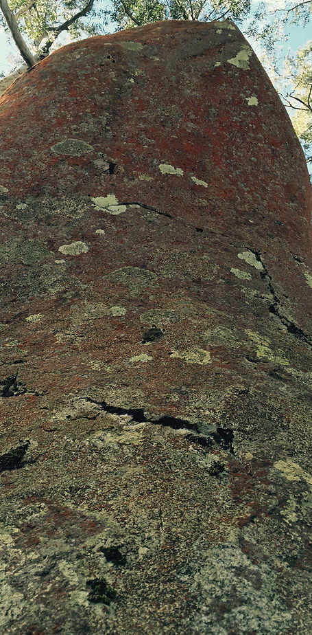
Gulaga Mountain (Mt Dromedary) NSW

Image 1 - The top of Gulaga and the views down to the coastline.

Image 2 - The locked gate at the start of the walking track

Image 3 - The sign informing you have reached Gulaga National Park
We headed past Pam's Store (there is a road of sorts, that travels adjacent) and set off towards the base of Mount Gulaga. Be aware that the first section of the roadway feels like you're walking onto someones property and trespassing. You are surrounded by beautiful manicured gardens on both sides, but you soon pass the section where the homesteads are, and continue along the road towards the base of the mountain. You really do get a country feel, with gently undulating grassed slopes, homesteads in the distance, and grazing sheep who eyed us cautiously the whole way.
After about a kilometre and a half, we came to a locked gate and a sign informing us that we had reached the Gulaga National Park (Image 2 and 3) and the the first uphill section. Before you go through the gate and commence on the walking track, it should be noted that a number of cars were parked at that location so you could cut out the first one and half kilometres of the walk if you wished. Having said that, I got the impression that the locals didn't like cars parked at this location.
After going past the gate, we commenced the first of the up hill part of the walk through a lovely forrested area, surrounded by small singing birds, darting about so quickly that we couldn't make out what type of species they were, let alone take photographs!
About 300 to 400 metres further on, you come to a section where a small sign marks the 'official' start of the climb to the peak (Image 4). From here, it continued up and up towards the peak of Gulaga Mountain.
At the start of the walk, I didn't think for one moment that this was a five hour round walk. But, you hit the uphill climb, which goes on for sometime, and you quickly come to appreciate that this is going to be a tough walk and there is no fast way to the top. I worked out quickly that it was best to take your time and enjoy the beautiful surroundings of rain forrest and mature ancient ferns (Images 5).

Image 5 - Ancient ferns surround the walking path
After about an hour and a half of walking, we finally reached the saddle and stopped at the picnic table for a cuppa and a break. Apart from the picnic table, there is a nearby toilet and an information board that tells you about the Aboriginal and white settler history of the mountain.
At the saddle, there are three tracks. Apart from the one we walked up, there was another track that came from the west and the third (the Summit Trail) on your left as you first arrive at that location. Take the Summit Trail and walk for about a kilometer until you reach the summit of Gulaga Mountain.
The track can be a bit tricky to follow, so keep a close eye out for the signs. You will first come across a sign, which directs you to the rainforrest (Image 7). Continue on the track and you begin to go downhill. This is a bit off-putting as it feels like you are heading away from the peak and going in the wrong direction, but you soon come to a track junction and you take a sharp right and begin the final climb to the peak.
From this point, to the peak of Mount Gulaga, is a spectacular part of the walk. Although VERY steep in parts, take regular breaks and enjoy the ancient rainforrest and magnificent trees. This area had such a unique feel and was such a beautiful area that seemed to invite you to stay forever (Images 8 below and 9 below right).

Image 8 - The beatiful rainforrest near the peak of Gulaga Mountain
After arriving at the top (Image 1) we stopped to enjoy the feeling of making it to the peak of this wonderful mountain. The views were great but the tree growth prevented a completely clear panoramic view of the coastline.
After enjoying the peak of the mountain, we headed back down and after arriving at the saddle rest spot, decided to explore another track, which took us to the granite tors outcrop. This track is just near the picnic table to the north and only about 300 metres to the Granite Tors (Image 10, 11 and 12).
After enjoying the Tors we commenced the walk back down the mountain and reached Pams Store about an hour before sunset, feeling very tired from the demands of the work but most importantly, very rewarded for our efforts.
I would recommend this walk but give yourself plenty of time so you can take in all that the mountain has to offer.

Image 10 (above) - the beautiful mountain eucalypt forrest surrounding the tors
Image 11 (above right) - one of the ancient tors
Image 12 (right) - one of the many configurations of granite boulders that make up the tors.
This is a tough, but very rewarding walk. It provides views of the beautiful country side around Tilba, traverses through shaded rainforrest paths, and as you make your way towards the top, you're surrounded by ancient rainforrest trees and a descent view at the peak (Image 1)!
Walk Rating: Medium to Hard. This walk is around 16 kilometres in length and almost the entire outward leg is up hill, with some fairly steep sections. If you’re reasonably fit, the walk will take around 3.5 to 4 hours, but allow much longer to take in the views and the magnificent rain forrest surrounds. The general recommended timeframe for the walk is 5 hours (return).
Directions: To get to Tilba, head to Narooma and then continue south on the Princess Highway for around 19 kilometres where you will reach the intersection with Corkhill Drive. Turn right onto Corkhill Drive and follow this road for about a kilometre and you will come to the township of Central Tilba. At the intersection as you come into the township, veer left and follow the road until you reach Tilba Tilba (about 7 kilometres).
At this location you will see Pams Store on the right and there is a small clearing just short of the store with some parking for vehicles.
The Walk: After parking in the grassed ‘carpark’ adjacent to Pams Store, we readied our packs and commenced the walk. If you haven’t been to this part of Australia, I would highly recommend it. The countryside is picturesque and the township takes you back in time. So quite and peaceful.
The Gulaga Mountain area itself, is significant to the traditional Aboriginal people – the Yuin. The Gulaga mountain holds particular spiritual significance, a place of ancestral origins symbolizing spiritual identity for Aboriginal men and woman.
Just outside Pam’s store, we came across two local Aboriginals and stopped for a quick chat. They told us that they would normally happily accompany people on the walk, but they were returning from a relatives funeral and didn't feel up to it. Understandable, but what a treat that would have been!

Image 4 - The 'official' start of the walk - all up hill from here!

Although physically demanding, the walk along the pathway through the Gulaga National Park was peacful and tranquil (Image 6). It had been several weeks since I last did a walk, and I had forgotten how important this feeling was to me. This is surely a form of meditation. How quickly everyday life takes over and if you are not determined, will stop you doing the things that you love the most.
Anyway, back to the walk! It really did seem like this up hill section of the walk went on forever, and I kept a lookout for the small saddle, which according to various sources of information about the walk, provided a rest area and picnic table for what would be a welcome respite.
Image 6 - A demanding uphill walk, but you are surrounded by a tranquil rainforrest

Image 7 - Once you reach the sign, follow the directional arrow

Image 9 - The ancient rainforrest trees near the peak of Mount Gulaga