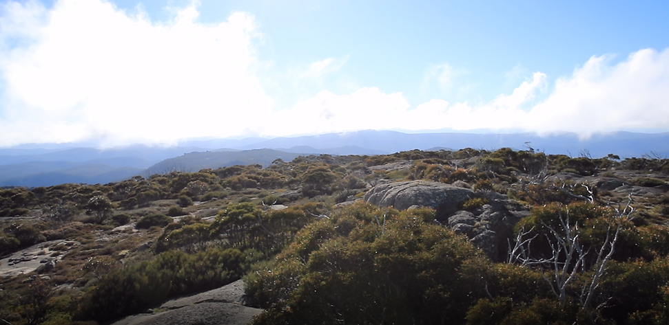
Mt Namadgi

Image 1 - The spectacular view from the peak of Mt Namadgi
If you are considering doing one of Namadgi National Parks toughest walks, do so with the upmost respect for this significant cultural Indigenous site. Shortly after completing this walk, I wrote these words, which I believe reflect my own experience of that trip, but also my own growing self-awareness of our local ancient historical cultural and spiritual landscape.
It’s a long tough walk to get to the top of Mt Namadgi and I couldn’t help but reflect on the cultural significance of the stone arrangements. This spiritual place sits atop a windswept mountain top, battered by the ravages of weather and time, and surrounded by panoramic views of this ancient land, a view that will stay with you forever.
As the clouds rolled by and the wind swept passed, bringing that icy chill that you get in these high areas of Namadgi, it felt like such a lonely spot, even though I was surrounded by the warmness and good nature of the walking group. In a way, the location felt surreal, significant and yes, spiritual. But, it also seemed one removed from our group, significant evidence of a past spiritual practice from a people who must have gone to great lengths to not only travel to this mountain top, but to recognise and maintain its significance and spiritual meaning over many thousands of years.
Now, after thousands of years of culture, here was our small group visiting this sacred place. A relic of the past? Perhaps it should never have been interfered with. In a way, I felt like a trespasser and I really don’t hesitate to admit, I felt as if I should have gained permission to be there, that I needed the blessing of the Ngunnawal or perhaps the Ngarigo people, or both.
Perhaps the feeling of one removed is a reflection of the current political state in Australia. A genuine and meaningful treaty with the Aboriginal people seems just that, one removed. I hope not, and I hope to see the day that a meaningful treaty is reached in my lifetime. Such is the impact that a visit to Mt Namadgi has.
Although I couldn't see it at the time, I now feel like I really found the Namadgi Trail.
This walk was completed prior to the 2020 fires. The area remains closed after the fires largely decimated the beautiful landscape that is the route to Big Creamy Flats and Mt Namadgi (as well as surrounding mountains).

Walk Rating: Hard. This is an overnight walk. The majority is not on a walking track and you have to pick your way through the scrub. You will need a map and compass and the ability to navigate. All Grid References from Rendezvous Creek 1:25 000 map 8626-1S
Directions: To get to the Yankee Hat car park, you drive to Tharwa. Once over the bridge, swing left onto Naas Road. From here it's around 32 kilometres,so enjoy the beautiful picturesque scenery and the wonderful mountains!
Continue on Naas Road until you pass the interesection with Apollo Road (leads to the old Honeysuckle Creek Tracking Station - another beautiful spot). From this point, Naas Road ends and Boboyan Road starts. Follow Boboyan Road and pass the turn-off to Orroral Valley and a little further on you will pass the Glendale Depot. This is a National Parks depot and services the needs of the rangers and Parks personnel with upkeep and maintenance of roads and infrastructure.
Continue past the depot and go past the car park at Rendezvous Creek. From here it is only a little further. Keep an eye out for the small sign (Old Boboyan Road) on the right side of the road. If the road changes from tar to dirt, you have gone too far!
Turn off to the right and the well-maintained dirt road will take you to the Yankee Hat car park. There are two small weirs to cross, but generally there are no problems with a two-wheel drive (except when the creek is in flood of course).
From the Old Boboyan Road turn-off to the Yankee Hat car park is around 3.5 kilometres.

Image 2 - The walking group crossing the grasslands with Mt Namadgi in the distance.

Image 3 - A short break at the Aboriginal Rock Shelter with the group entertained by my walking buddy, Jamey.
The Walk: DAY ONE This was the first time I'd been on a walk with a group of other walkers and the first time that I'd shared a walk with well known bush walker - JohnnyBoy. I've done other tough walks, but be warned about this walk, it is deceptive as you can see Mt Namadgi from the car park and it really doesn't look that far. But once you hit the scrub and get off the defined walking track, the going is tough and the climb towards Big Creamy Flats (at the base of Mt Namadgi) is relentless.
After arriving at the Yankee Hat car park, my offsider and I were introduced to the walking group. This particular walk was an organised walk, led by John Evans for the Canberra Bushwalking Club. It was the first time I had ever ventured out on an organised walk as most of my treks into the bush were either solo, or with one other person (I know, against my own safety advice on this website)!
After introductions, we all slung our packs (quiet an array of gear I might add) and headed off across the open plains of the Yankee Hat grasslands just after 7.00am. The first part of this walk is following the Yankee Hat walking track (that takes you to the Aboriginal Rock Art). Instead of walking to the rock art -after about 1.5km (after crossing the bridge over the creek) - we headed north west over the small knoll as this was more of a direct line to our first navigation spot at the Aboriginal Rock shelter (that walk also on website).
On the other side of the small knoll are the sweeping Gudgenby grasslands, shadowed by the surrounding mountains (Image 2), with numerous grazing Eastern Grey kangaroos. They eye you suspiciously as you pass of course, but they are somewhat used to people as the walk to the Aboriginal Rock Art is a popular one.
Continue to the north west for another kilometre and you will come to a dirt access road (very rudimentary but you can't miss it). You may come onto this track at the remnants of old fencing posts.
Turn right and follow the access road until you see the remnant of the second old fence gate on your left - GR 7700 4288 - which consists of the old gate posts but no actual gate. Follow this track until it pretty much comes to an end. From the second gate to the rock shelter is a distance of just over one kilometre.
At this point, you will have to find a spot to cross Middle Creek as the Rock Shelter is on the other side, as is the walking route to Big Creamy Flats. On the day our group was there, the water level wasn't too high so provided a couple of reasonable crossing points. With heavy packs, it made for an interesting big step across the water to avoid waterlogged boots! Not pretty, but effective.
Our group stopped at the shelter (Image 3) for some re-hydration and a short break - GR 7575 4370. It's great to stop and enjoy the rock shelter, remembering to respect the wishes of the Ngunnawal custodians. There is a sign at the rock shelter to remind you of the sensitivity of this site and what you can, and more importantly, cannot do. I found this location very humbling, reflecting on the spiritual significance of this place and the Aboriginal history over thousands of years.
After our short break, we once again slung our packs and headed to the west. This first section (Image 4) takes you around 750 metres until you come to an old disused fence line - GR 7525 4400. Cross the fence line and continue to head north westerly with Middle Creek on your left. You are pretty much following Middle Creek for most of the way.
Things started reasonably well, but I could see that not too far in front of the group, the bush was about to close in around us, and the further ahead I looked, the thicker it seemed to be (Images 5 and 6). It's after you cross the fence line where the scrub starts to get thick, but you do get the odd area where the going is a little easier. Head towards these areas, and pick your way through the thicker stuff.
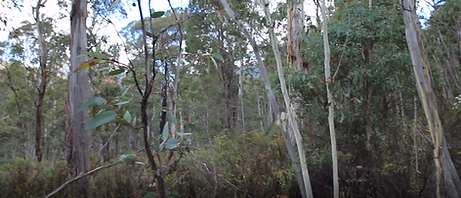

Image 7 - This photo taken just as we came out from the incline and entered the western end of Big Creamy Flats.
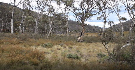
Image 8 - the view over Big Creamy Flats looking East to North/East
Although now on fairly flat ground, the tussick grass still made it hard going. Pretty much all of our group had run out of water by this stage so we stopped at the first small water channel we came across, which looked like it was water running off Mt Namadgi. It was an ideal water source as it was crystal clear, filtered by the tussic grass as it chanelled itself into a tiny under run, making its way down to Big Creamy Flats.
With pack of water purifying tablets in hand, I had the honours of filling everyones watering bottles, bladders, camelbacks, etc. After re-supply of water, we only had one hour to wait, whilst the purifying tablets did their work!
We finally arrived at John's fantastic campsite (around 3.30pm) and it indeed was that. A flat rock granite slab surrounded by the grassland. An ideal place to fire up the burners for heating food, without and chance of accidentally starting any fires (Image)! GR 7130 4375.
After re-hydrating (slightly) with a cup of tea (Earl Grey never tasted so good), we set up camp and I got some of the camera gear out to do some filming. With the shadows now starting to lengthen, some dark clouds rolled in - not a welcoming feeling at all, and this was the first time on the trip that I felt the power of the mountain. There's a reason this is a sacred site to the local Indigenous people.
After finishing the piece of filming, our water was ready to drink and the group was very welcoming to the hydration it provided. After some food and with the sky darkening further, we all sat down for a chat before bedtime.
Two of our now expanded group had walked to Big Creamy Flats the previous day. Rob and Jenny have been bush walking in Namadgi for decades and are keen members of the Canberra Bush walking Club. Listening to their stories made me realise although there are only a few websites (like Johhnyboys walkabout and thewalkact) there are so many experienced bush walkers with so much knowledge to share - thanks Rob and Jenny (Image 11).
It was a relaxing evening and a great way to wind down after a strenuous day of walking. But, we had some more hard stuff to get through tomorrow. An early morning start was need to get to the top of Mt Namadgi and allow sufficient daylight for the walk back to the Yankee Hat car park.
We were all in bed early that night. We were surrounded by the sounds of nocturnal animals and I could hear an owl moving from spot to spot around our campsite. I think it was trying to work out what had changed in its normally people free territory. After a brief bit of rain during the evening, we awoke to a foggy but rain free morning.
DAY TWO
I packed a smaller pack with some basic film gear, with water and food and the group headed for the base of Mt Namadgi and the start of the incline. We broke camp and headed for the peak a little after 6.00am. Although a little chilly, we soon warmed up and the steep climb to the top soon shook off any of the aches and pains from the previous day.
If you're going to do this walk, we started at the base at GR 7100 4930 and then made our way to GR 7087 4865. The more experienced Mt Namadgi trekkers amongst the group thought this was the easiest way to the top - noting that there is no really easy way.
The going from the base to this location was as to be expected. A fairly steep incline with a lot of dense bush and like always, best just to pick your way through, looking ahead to the clearer spots.
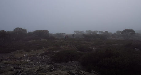
Image 12 - After 300 metres ascending, we came out onto a plateau just to the NW of Mt Namadgi peak.
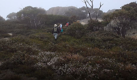
Image 13 - The approach to the peak of Mt Namadgi. The peak is the large granite mound above and ahead of the walking group.

Image 4 - After the rock shelter, you get an idea of what is in front of you. This is the last of the easier section.
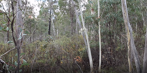
Image 5 (above) and Image 6 (below left) give you an indication of the thickening scrub and what was to come.
The going from this point was a little slow. I had conned a friend into helping me cart some film gear (as part of the filming for the documentary - Finding the Namadgi Trail) and to be honest, I hadn't really thought much about the weight we were carrying (I later worked out it was just under 30kg - I'm way too old for that).
Despite the extra weight, we plodded along, conscious that we were slowing the group down, who graciously kept telling us they were glad for the slower pace! 'It's not about the destination, but the journey that takes you there' - kept swirling through my mind!
After 5 hours since starting out from the Gudgenby car park we had covered 10 kilometres of pretty solid bush bashing where we stopped for lunch. From crossing the old fence line to the lunch stop, we had kept to the north of Middle Creek, meandering higher and lower depending on where the going was easier. It should be noted that this is an incline from the rock shelter to Big Creamy Flats so not only do you have to contend with the thick scrub, you also have to contend with the incline, and the weight of the gear you are carrying.
Despite a small dehydration issue, and other members of the walking group generously contributing some of their supply of electrolytes, it was a beautiful setting amongst the now quite thick scrub, but most welcome was that we had a moment to get the heavy packs off and relax.
At the start of this article, I spoke about the deceptive nature of the distance to Mt Namadgi. This was one of those spots. It seemed like Mt Namadgi was only just up ahead of us, and after studying the the map, I was bouyed by the fact that there was only two (ish) kilometres to Big Creamy Flats. Our lunch stop was at GR 7288 4780.
So after lunch, we slung our packs again (oh my god, I swear it was so much heavier now than when I started). Some of the walking party must have taken pity on both of us and a couple very kindly agreed to take a little of the gear (Robyn, you are a champion). Thank you guys!
We were now on the approach to Big Creamy Flats - a flat wetlands area at the northern base of Mt Namadgi. But, this approach is a deceptive part of the walk! We came across a flat area, which was relatively clear and despite the footing being a little uneven from the thick tussic grass, it was a welcome relief from the constant climb. GR 7265 4780.
The welcome relief was short lived however. After crossing the flatter area, we started the final incline, which takes you up onto Big Creamy Flats. I'm sure if you started the day on this incline, you wouldn't think too much of it, but after five hours of tough walking, this final stretch was an energy sapping period, which ended up taking us a little over two hours.
But, there was a reward for our hard walk, and with Mt Namadgi towering over us on our left, we hit the start of Big Creamy Flats, a magnificant combination of open grassland and wetlands.
John told us that there was another one kilometre to go to a 'fantastic' camping location. At that stage, I was readying myself to shed the heavy pack and associated bags of film gear! Oh well, John is a guy who has been here multiple times, so...I continued on towards the fantastic camping location.
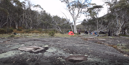
Image 9 - Our campsite adjacent to Big Creamy Flats. Mt Namadgi is to the left of this photo.
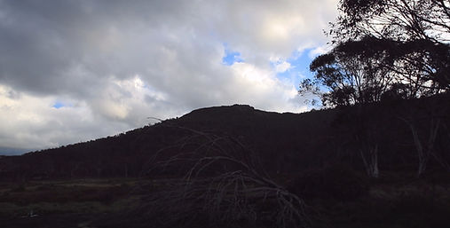
Image 10 - Mt Namadgi, towering over our campsite and seemingly towering over Namadgi National Park. A powerful and spiritual place.
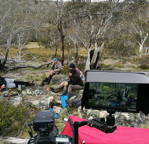
Image 11 - relaxing at our campsite after the hard day of walking. As a documentary maker, I've learnt that you always have to have your camera at the ready. As people get used to the camera, they forget about it and this is where the best stories come out.
I was a little worried on the ascent as the fog was very heavy and not clearing. Surely we weren't going to put in all this work to get to the top, and not be able to see our surroundings? I always feel robbed when I don't get to see the views from a high point.
After around 300 metres of picking our way through the scrub, having to contend with the usual array of granite outcrops and fallen trees, we came out of the scrub onto a flatter area to the NW of the Mt Namadgi peak (Image 12). It was still not easy going, as we had to step through low growing shrubbery, not able to see where your foot was going to make contact with the ground below the canopy. Best to take it slow here. However, it's only a hundred or so metres of this type of walking before you come out onto the granite slab.
This is where the very ancient culturally significant Aboriginal site is. The only knowledge I have of the area is that the local indigenous people used the spot for initiation ceremonies and it is considered to be a VERY significant location. It resembles a mini aircraft runway, with stone formations placed as if pointing to the South (or North if you're looking from the other end).
I haven't included the grid reference for its location as I don't feel that I should be advertising it (not my place to do so). However, you can find it fairly easier as it's not far from the peak of Mt Namadgi. There is also an information sign that tells you a little bit about the significance of the location. Please be respectful if you do visit and best to keep out of the area between the rock lines.
After stopping at this location, we continued to the peak of Mt Namadgi (Image 13). The fog had still not cleared and I began to resign myself to the fact that it wouldn't clear and there would be no wondrous views to admire.
It's only a couple of hundred metres to the top and a small scramble to actually get up on top of the granite outcrop so that you are truly at the peak of Mt Namadgi. The group shed their packs and John continued his tradition of opening a bottle of champagne on reaching a significant peak (I can't believe he carried it all that way). I must admit, although only a very small glass, it didn't go down all that well (sorry John)!
This was John's 70th birthday and he had wanted to come to the peak of Mt Namadgi as he had described it as his favourite location in Namadgi. Despite telling us all that at 70 years of age, this would be his last time, he did say: "This will be my last time ,but you get home and have a shower and a cold beer and you forget about how hard it is". Hopefully he's got another trip.
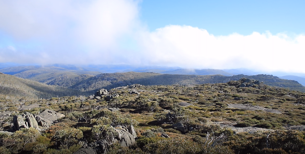
As we relaxed with the very small sample of champagne, the sun suddenly burst out and the fog began to blow away. Just as suddenly, we were surrounded by breathtaking mountain views in all directions (Image 14 (left and Images 1 at start of page and 15 and 16 below).
It was a great moment and despite the hard work in getting to the peak, I began to understand why this was a favourite destination in Namadgi National Park for some people. A truly great Namadgi bush walk!
But, in the back of our minds, we all knew that we still had some hard work in front of us. Just like the start of the walk when Mt Namadgi seemed like it was only a short distance away, we could actually see the Yankee Hat car park. It too looked as though it was only a short distance away! But the estimated return journey was 9 hrs!

Image 14 - Hurray! The fog blew off and the sun burst through. Spectacular views in all directions.
After doing some filming and getting a few words of wisdom from John, we all packed our gear, slung our packs and headed back down the mountain to our campsite. After arriving at the campsite, we all made short work of packing up. Ready to go, I lifted my pack and film gear onto my tired shoulders (once again, the weight seemed to be heavier than when I started) and we commenced the journey home at a little after 10.00am.
After coming off Big Creamy Flats we commenced descending, a lot easier than coming up! I think we made really good time and covered 2.3 kilometres in a little over 1 hour and 30 minutes. At this stage we stopped for an early lunch. When you carry a heavy pack, any sustenance is always most welcome!
Rob led the way after lunch, expertly picking his way through the scrub and finding easier routes for all. We pretty much followed the route that we took to Big Creamy Flats, with a few variances to avoid some really heavy growth.
We arrived at the Aboriginal Rock shelter around 5pm (just under 7 kilometres in 4.45 hours) and this was a very welcome break. It was evident that the group was pretty worn out so the respite was welcomed by all. John had soldiered on with feet problems and was really starting to feel it, but not long to go now and I think this spurred everyone on!
We covered the last four kilometres back to the Yankee Hat car park with heavy legs and heavy packs, arriving at around 6.30pm. It felt good to shed the pack for the last time! I sat with my pack horse buddy for a period and we both took our boots and socks off (which always feels really good when you have tired feet). I looked down at Jamey's feet and they were completely shredded from blisters - I'm talking really bad blisters. I chastised Jamey for not saying anything, particularly as I have a blister first aid kit in my pack. Needless to say, I'll be using him again in the future!
What an incredibly tough two days, but also an incredible walk with a fantastic group of people. We all said our goodbyes and headed home. That night after a shower, a hot meal and a glass of red, memories of how tough the walk was began to fade, and I did indeed start to think about my next journey to Mt Namadgi! John was right!
Footnote:
As mentioned at the start of this article, the 2020 fires ripped through that area and I've been informed by ACT Parks and Conservation that the area has been largely decimated. One of the rangers flew into Big Creamy Flats by helicopter and described the feeling as eerie. A normally prolific location for native animals and birds was strangely silent. Fingers crossed that this area can recover from the decimation.
